
Monitoring Wells in Orangeburg County
Click well ID to retrieve daily average groundwater levels
| Well ID | Elevation | Latitude | Longitude | Depth | Aquifer | Status |
|---|---|---|---|---|---|---|
| ORG-0079 | 180 | 33 24 47 | 08 05 51 | 995 | McQueen Branch | no longer monit. by SCDNR or USGS, still exist |
| ORG-0385 | 175 | 33 22 08 | 08 10 51 | 535 | Black Creek | Actively monitored continuous ADR site |
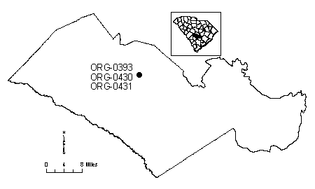
| ORG-0393 | 256 | 33 30 30 | 08 05 54 | 463 | Black Creek | Actively monitored continuous ADR site |
| ORG-0430 | 256 | 33 30 30 | 08 05 54 | 275 | Tertiary Sand | Actively monitored continuous ADR site |
| ORG-0431 | 256 | 33 30 30 | 08 05 54 | 93 | Floridan | Actively monitored continuous ADR site |
| ORG-0634 | 165 | 33 27 16 | 08 04 06 | 256 | Floridan | Actively monitored continuous ADR site |
Status column:
ADR: Water level is continuously measured on an hourly basis.
Manual: Water level is periodically measured on a bi-monthly basis.
Inactive: Water level is not currently monitored.
Abandoned: Well has been permanently abandoned and water levels can no longer be measured.