
Monitoring Wells in Laurens County
Click well ID to retrieve daily average groundwater levels
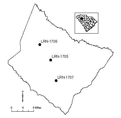
| Well ID | Elevation | Latitude | Longitude | Depth | Aquifer | Status |
|---|---|---|---|---|---|---|
| LRN-1705 | 638.73 | 34 29 27 | 08 20 35 | 39 | Shallow Aquifer System | Actively monitored continuous ADR site |
| LRN-1706 | 840 | 34 34 15 | 08 20 50 | 168 | Crystalline Rock | Actively monitored continuous ADR site |
| LRN-1707 | 660 | 34 22 53 | 08 20 23 | 223 | Crystalline Rock | no longer monit. by SCDNR or USGS, still exist |
Status column:
ADR: Water level is continuously measured on an hourly basis.
Manual: Water level is periodically measured on a bi-monthly basis.
Inactive: Water level is not currently monitored.
Abandoned: Well has been permanently abandoned and water levels can no longer be measured.