
Monitoring Wells in Dillon County
Click well ID to retrieve daily average groundwater levels
| Well ID | Elevation | Latitude | Longitude | Depth | Aquifer | Status |
|---|---|---|---|---|---|---|
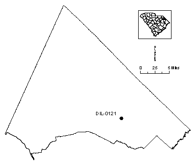
| DIL-0121 | 95 | 34 19 43 | 07 91 59 | 294 | Middendorf | Actively monitored continuous ADR site |
| DIL-0171 | 85 | 34 19 49 | 07 91 13 | 555 | Cape Fear | Actively monitored continuous ADR site |
| DIL-0172 | 85 | 34 19 49 | 07 91 13 | 175 | Black Creek | Actively monitored continuous ADR site |
| DIL-0173 | 85 | 34 19 49 | 07 91 13 | 380 | Middendorf | Actively monitored continuous ADR site |
| DIL-0174 | 85 | 34 19 49 | 07 91 13 | 75 | Black Creek | Currently monitored by USGS |
| DIL-0175 | 85 | 34 19 49 | 07 91 13 | 325 | Middendorf | Actively monitored continuous ADR site |
Status column:
ADR: Water level is continuously measured on an hourly basis.
Manual: Water level is periodically measured on a bi-monthly basis.
Inactive: Water level is not currently monitored.
Abandoned: Well has been permanently abandoned and water levels can no longer be measured.